Going in the Off Season
We went in April so technically the park wasn’t open yet. I called because I remember seeing signs about the road being closed because of snow so when I called I wanted to make sure we didn’t waste a drive and couldn’t get there. They said we are more than welcome to walk around on the path but that there wouldn’t be parking.
Tip – always check nps.org the day you go to any park so if there is closures you know!
Sure enough we get there, parking lot is gated shut but there were other cars off to the side parked on the road. You just had to find a little dirt section and it was totally fine. The road had ZERO traffic so it wasn’t a big deal.
Drive in
So we came from Fresno to the trail head and it took about 2.5 hours. We decided to do this one because when we looked at the map… oh my gosh, it was so many tight little turns in and out and neither of us wanted to do that again after the Yosemite drive. So we decided to go to the south portion and not drive the entire winding road. Trail of 100 Giants is one of the last places you can go that was still going to be cool without trying to get to the Giant Sherman. SO MANY TURNS.
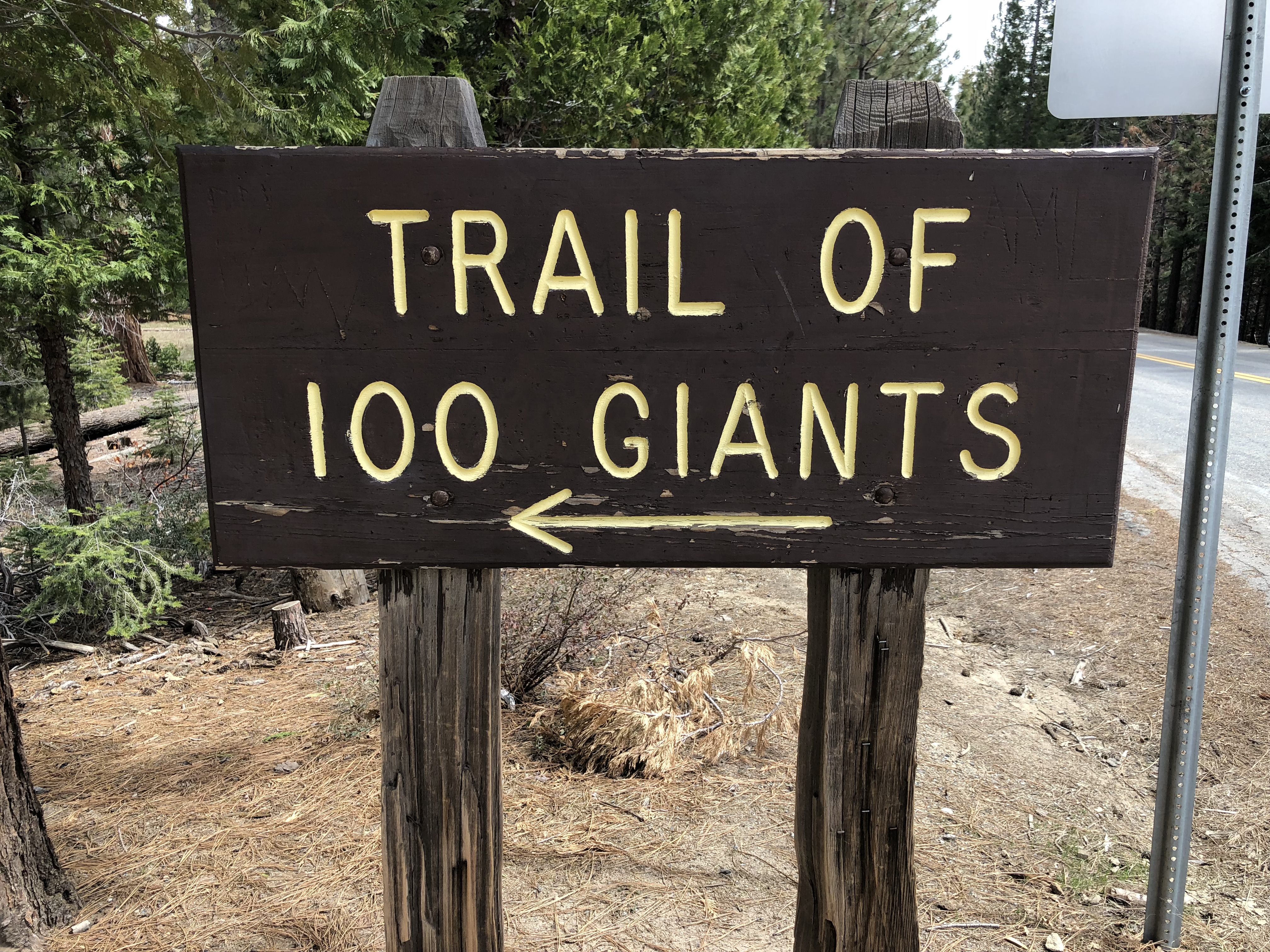
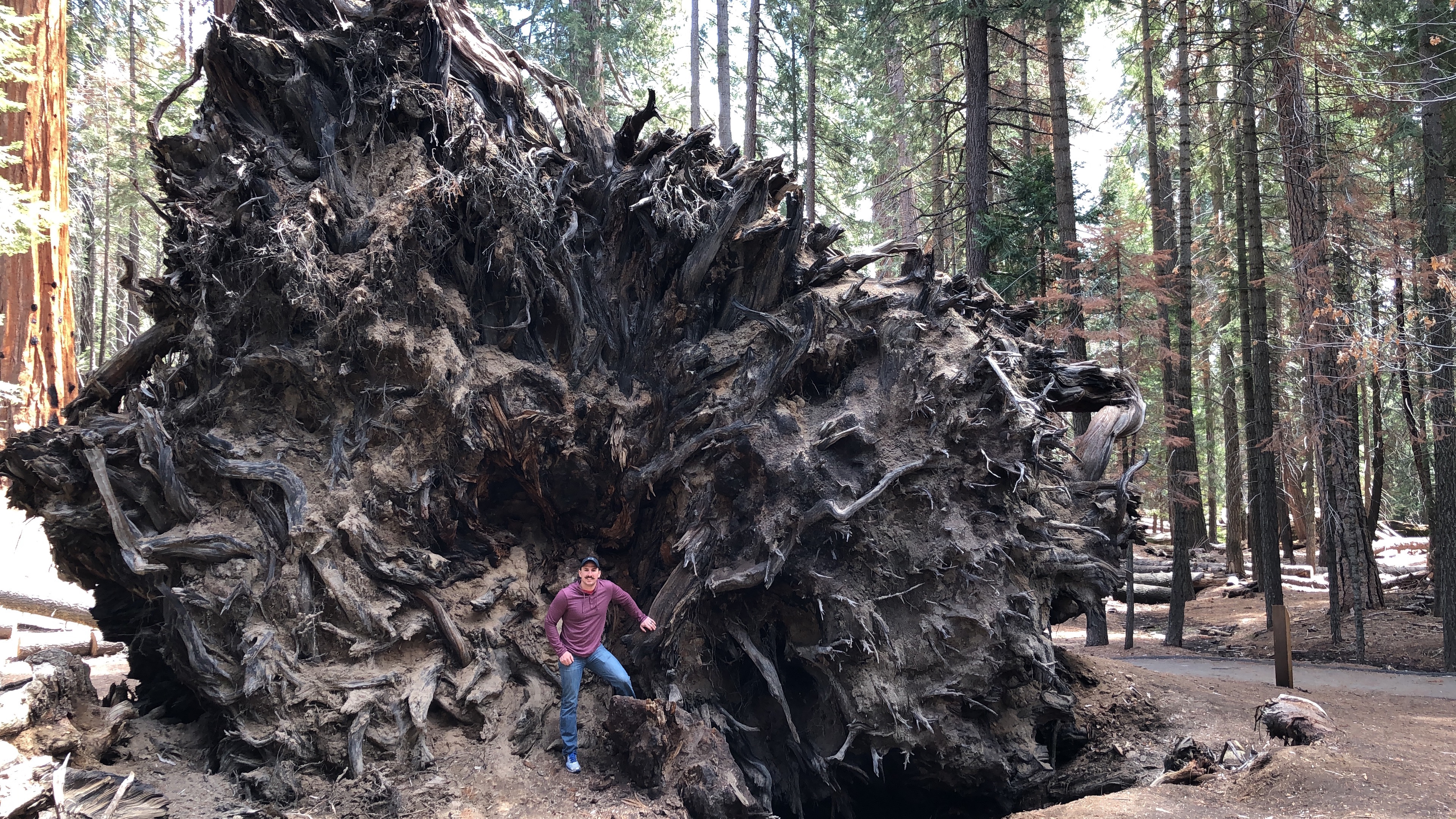
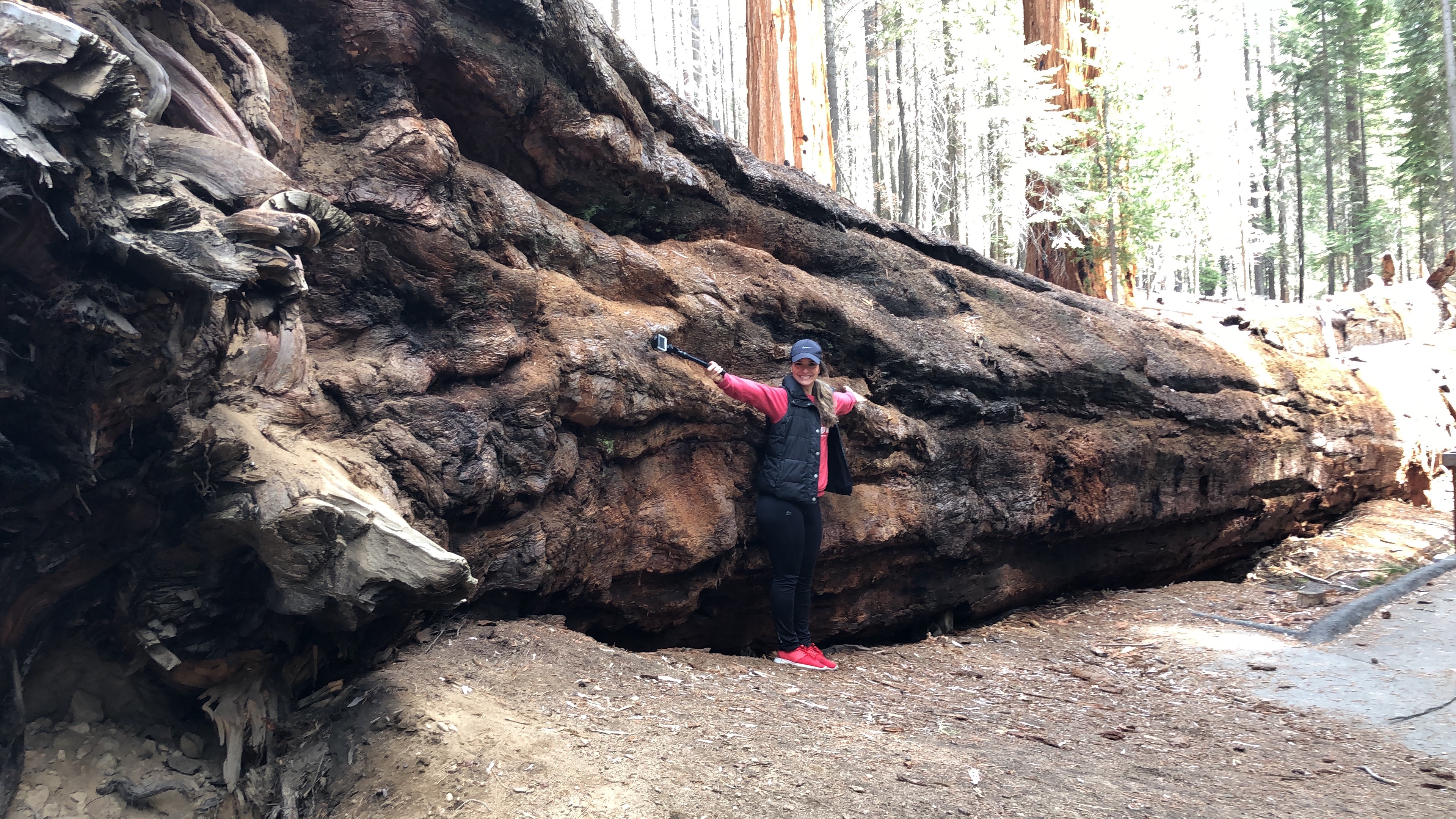
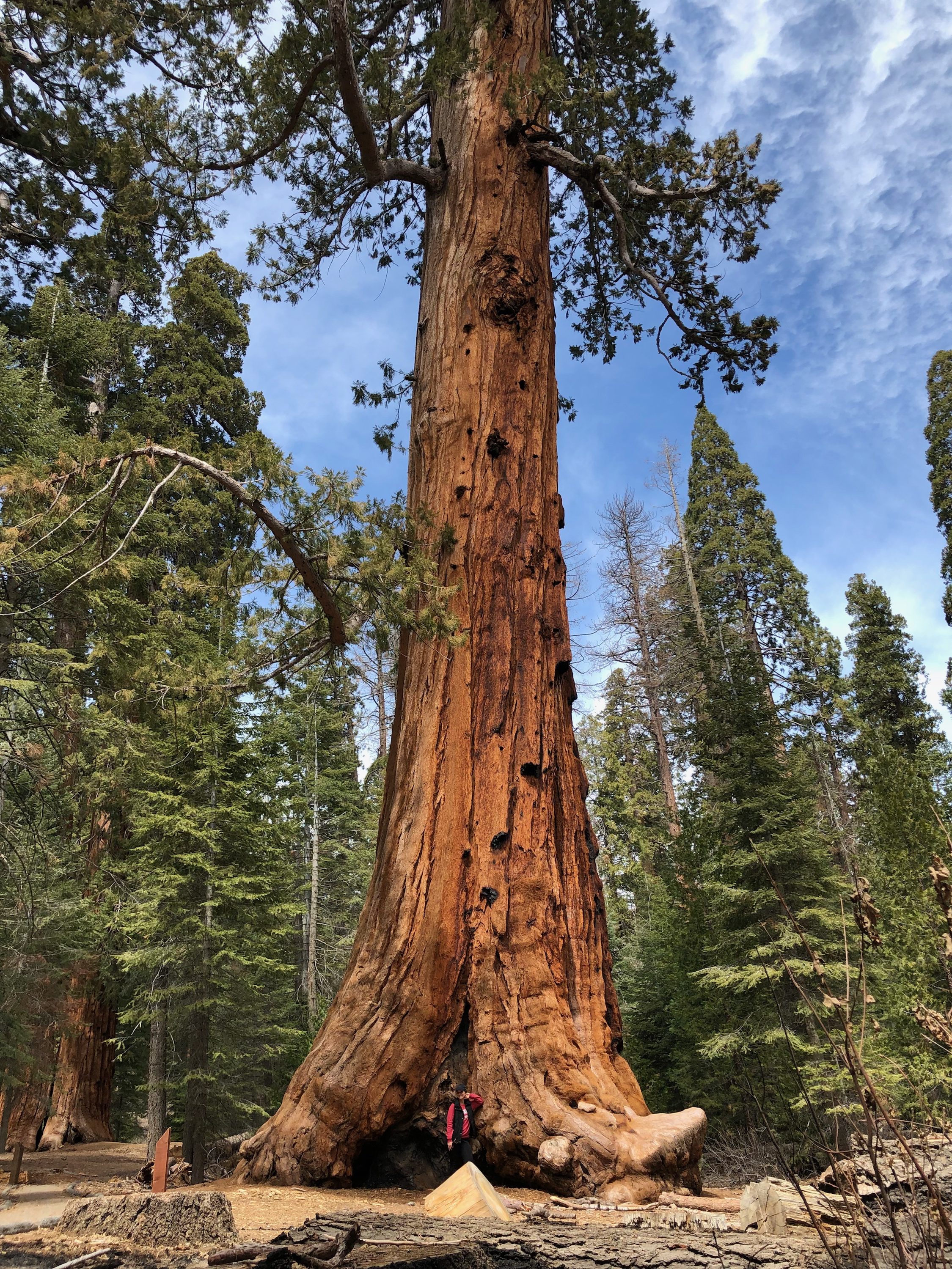
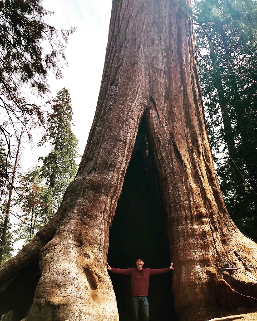
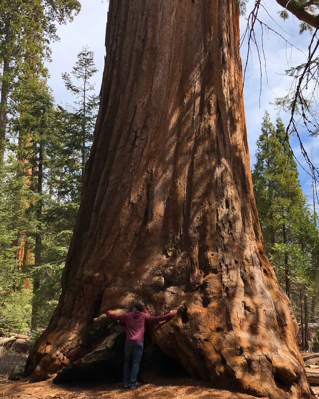
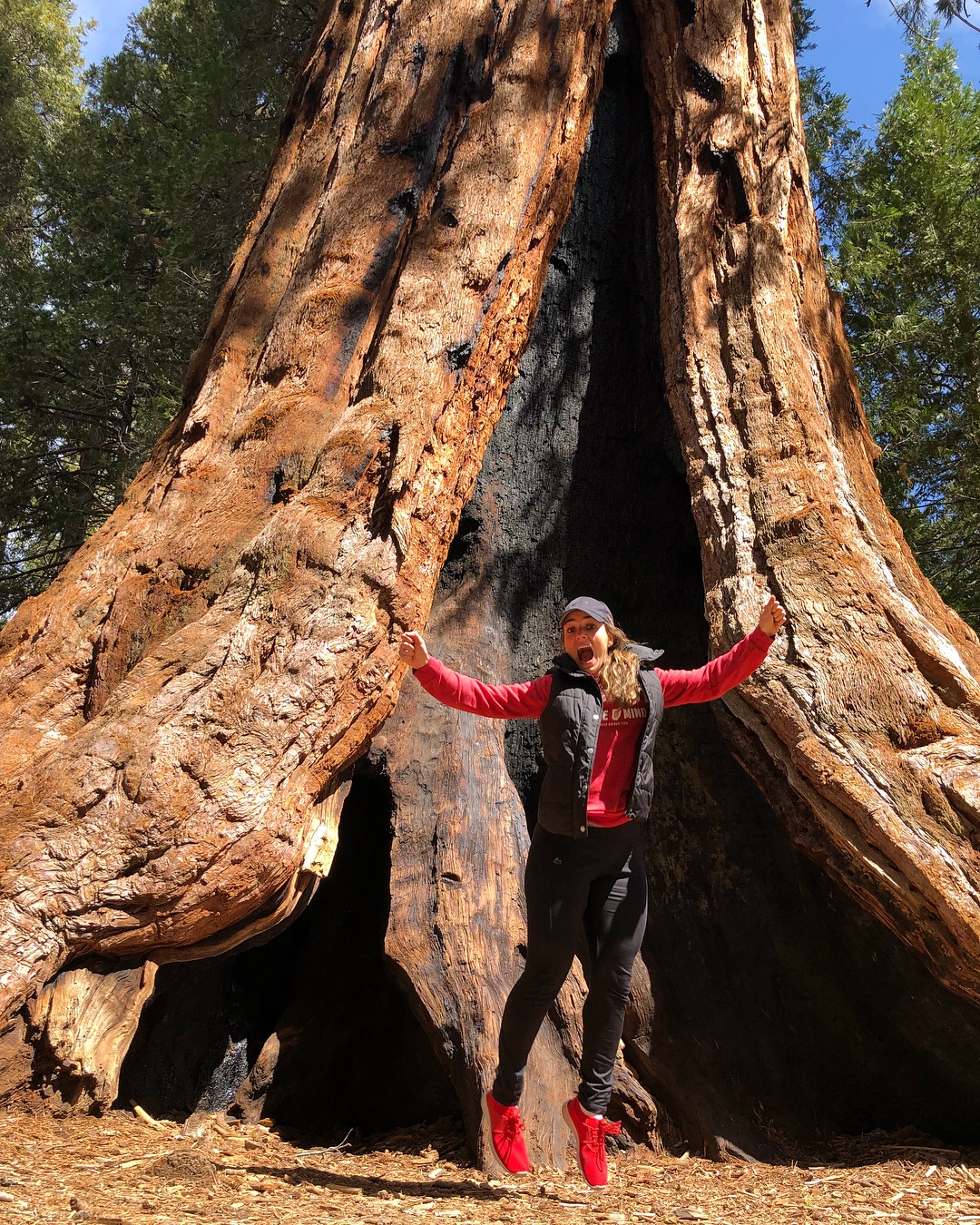
Trail of 100 Giants
Like I said we parked off to the side of the road and started where the trailhead was marked by an old wooden sign “Trail of 100 Giants”
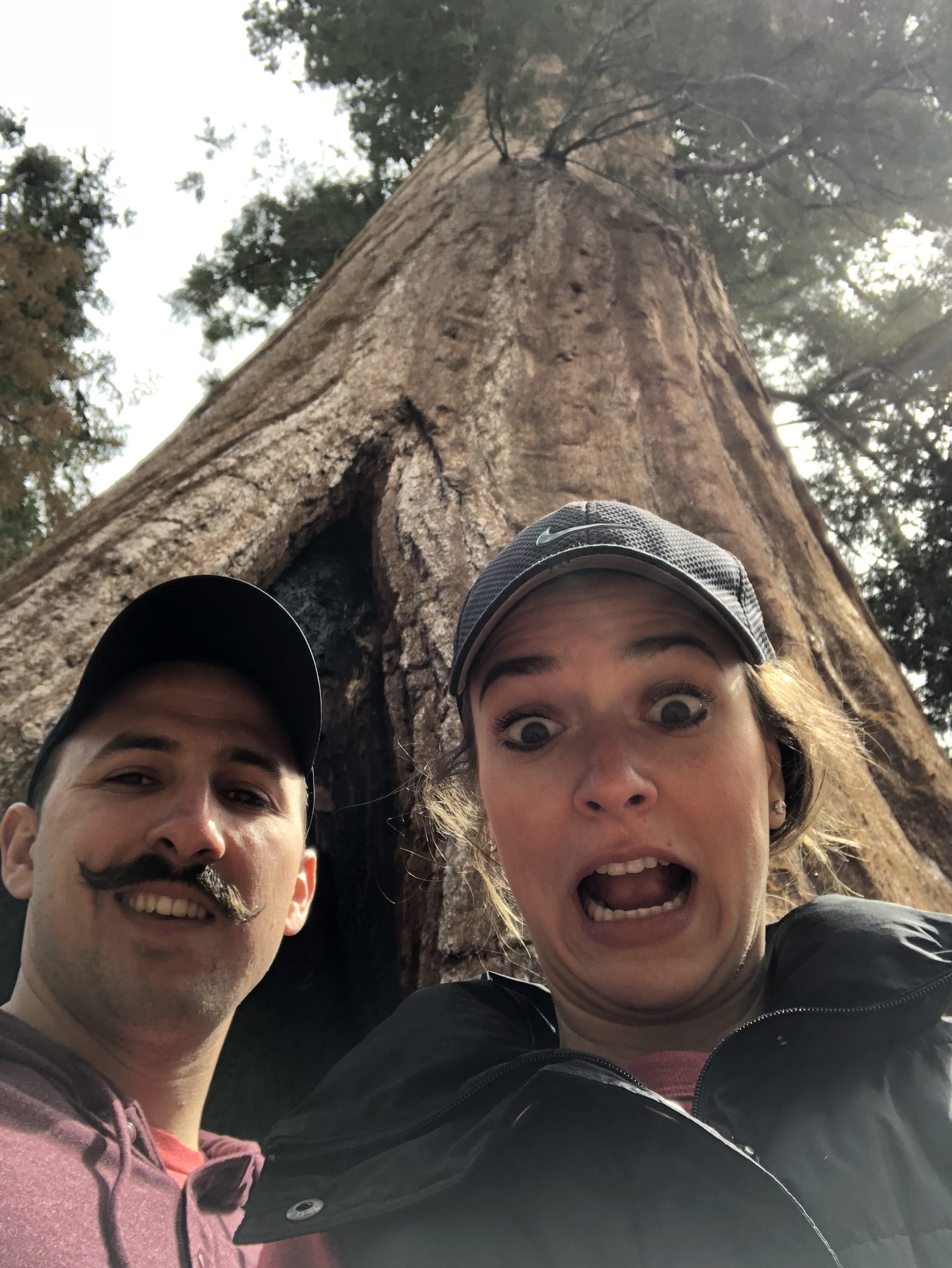
Wow. I think this may have been my favorite stop. The trees were just amazing. They’re absolutely HUGE. It’s hard to explain without seeing it in person but you’ve seen the pictures of people walking in them or trying to hug them.
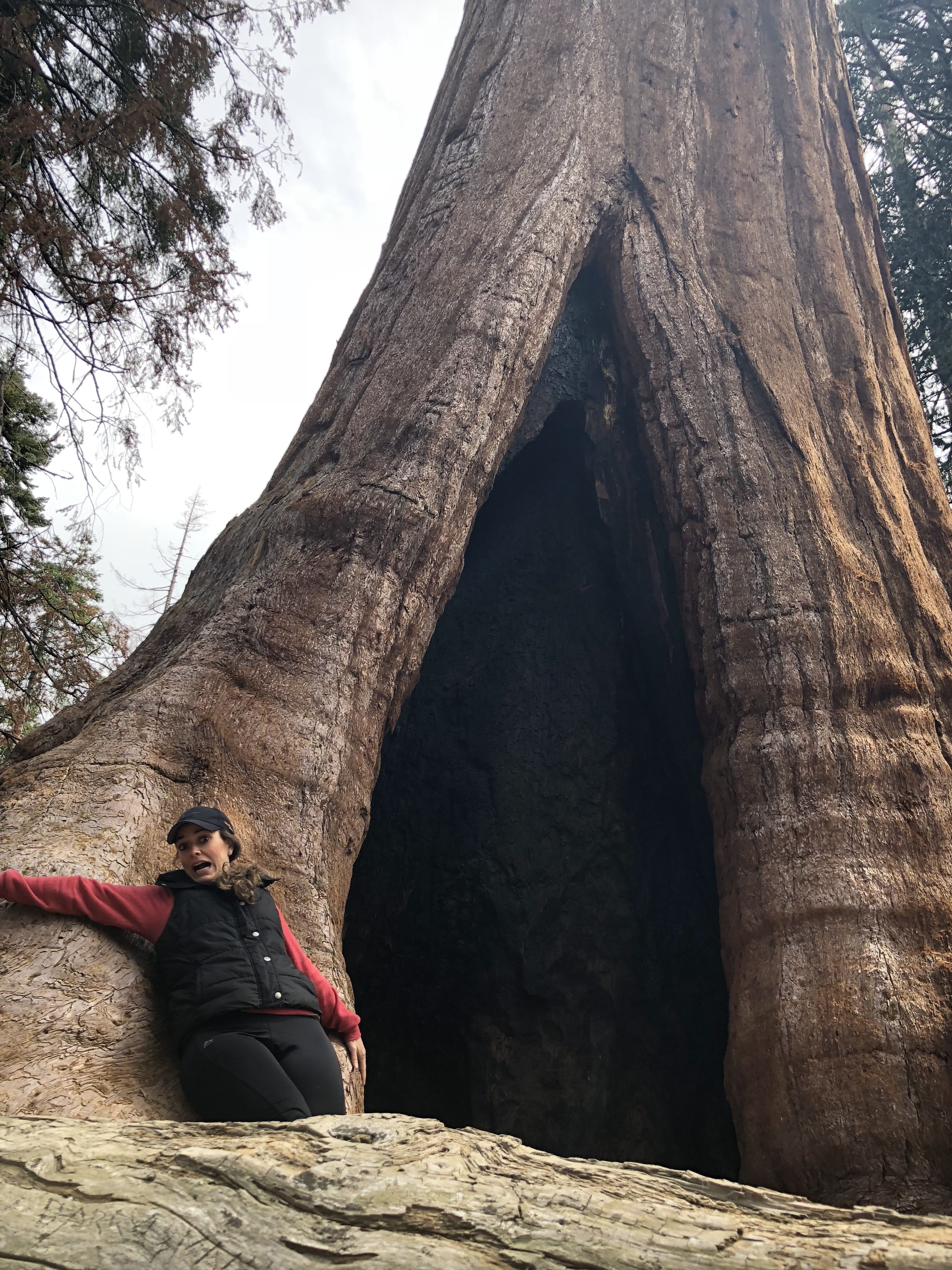
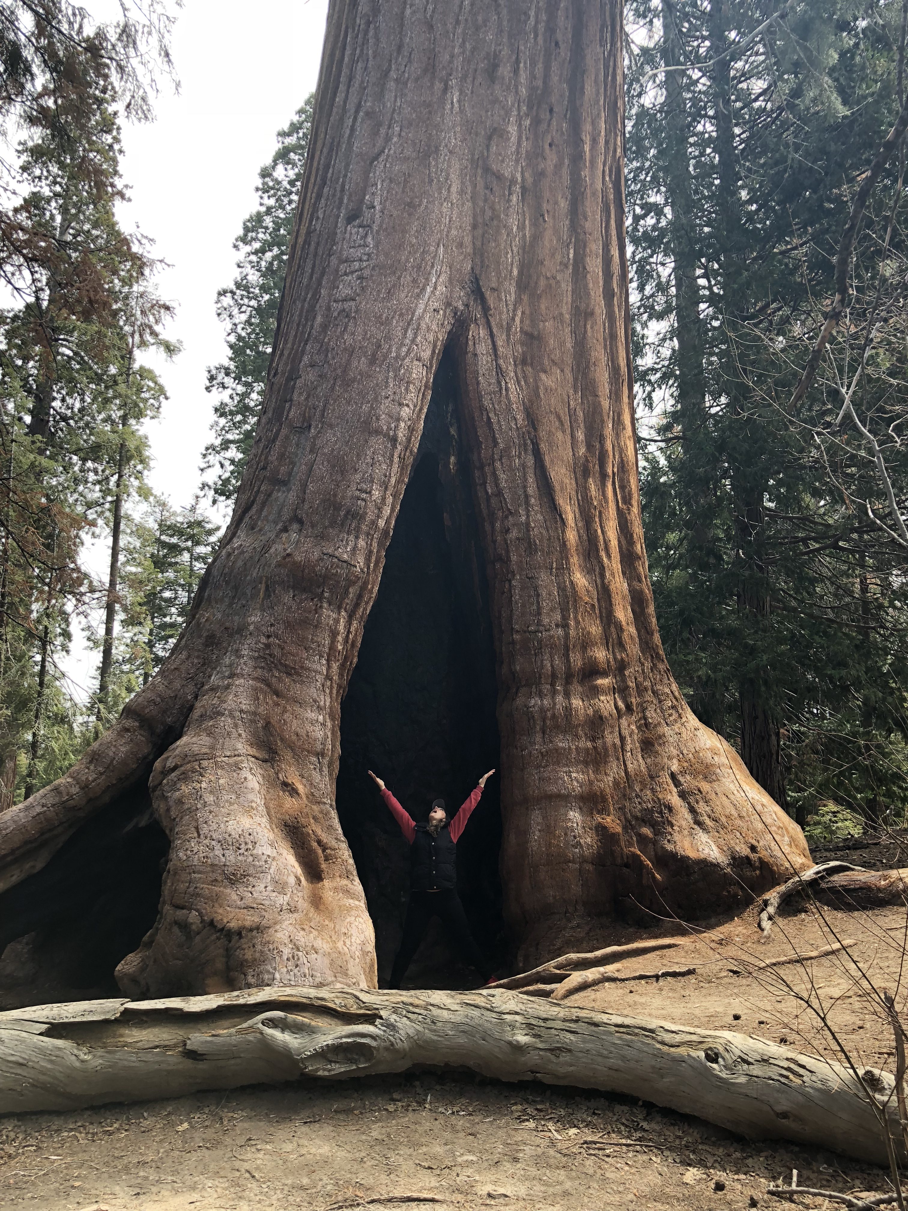
There’s one tree that they call the fallen giant and you can see the base and root system of these giant trees. You feel so small and it was just so cool to look at!
Clothes Tip – The weather was really chilly up there – maybe in the 50s of 60s. You’re up in the mountains (it was April) and basically in a tree canopy so no sun really directly hitting you. Dress with layers.
Driving Tip – Per usual, we had ZERO service about an hour out once you get into the Sierra Nevada’s. So we had it pulled up on our phone and it was really one road. Problem was we were going to Bakersfield after and we had NO idea how to get there. I pulled it up on my phone and we went south past Isabella Lake. Pretty much guessed at turns. SO write it down or look it up before you go and try and Cache the maps!
Drive to Bakersfield
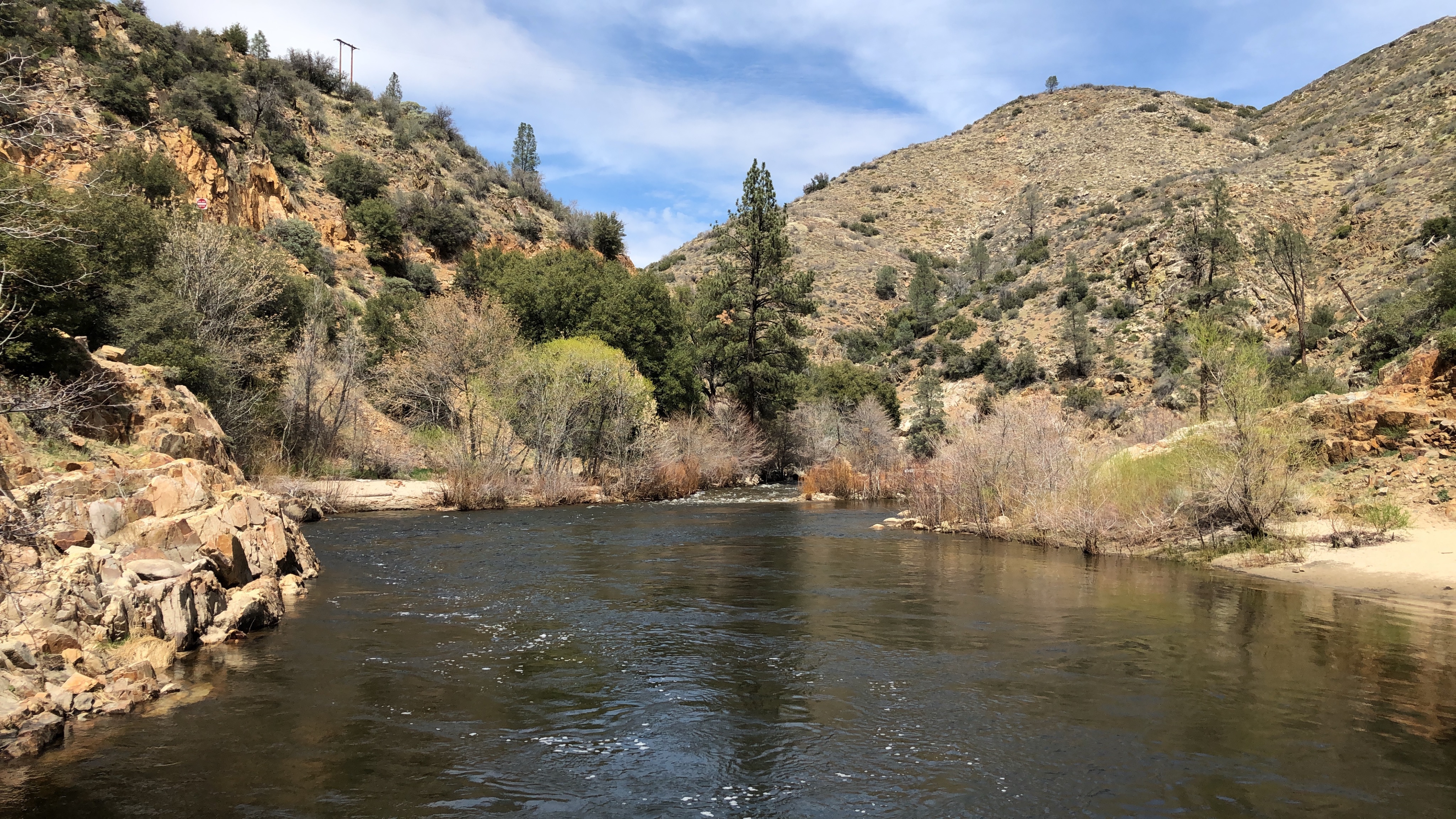
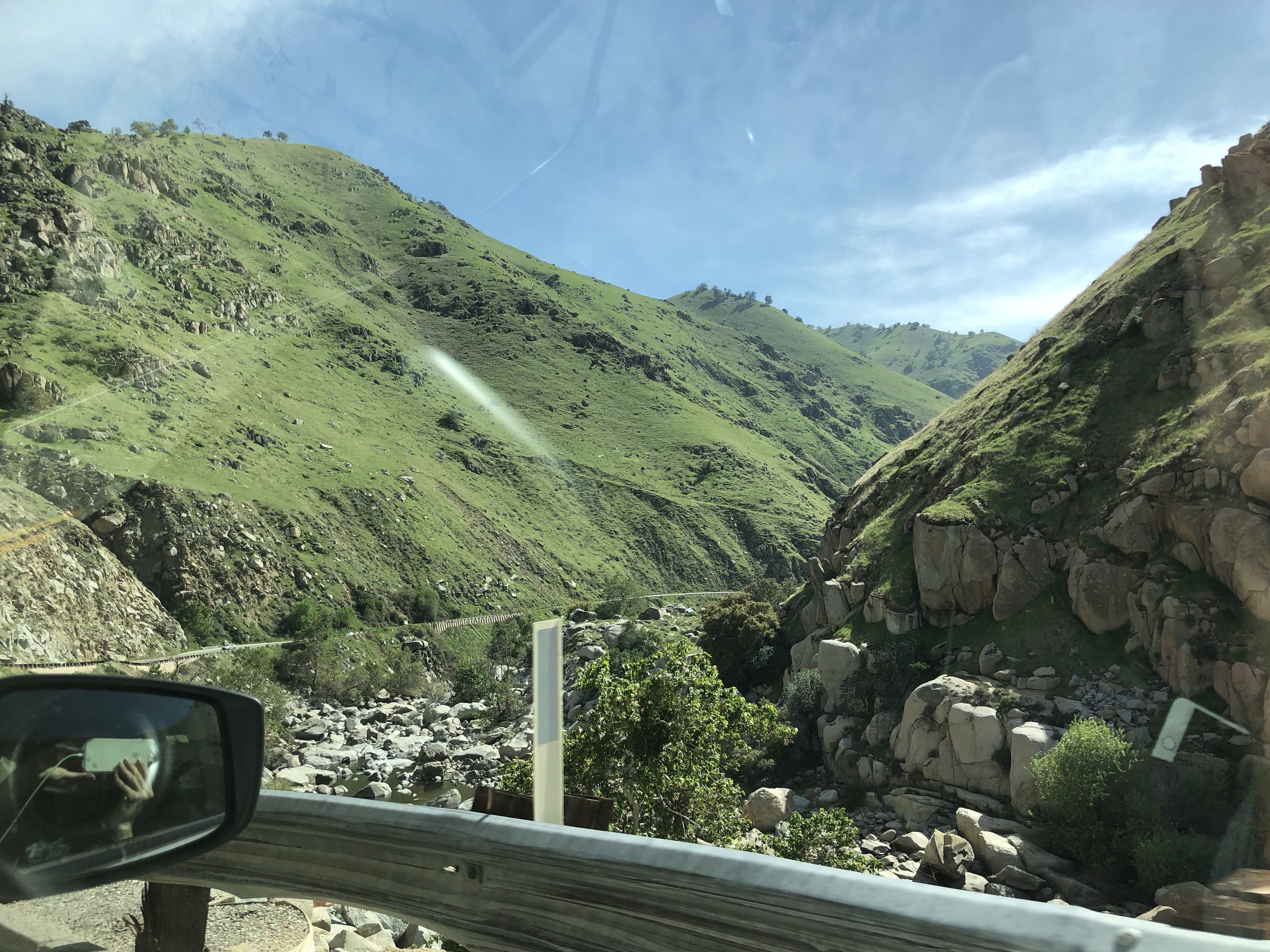
Since we only did the one trail, we were done pretty early and left for Bakersfield. We took the south road and Ricky turned down a road that said “closed due to snow” because it was the way we wanted to go. I was nervous that at any point we were gonna be stuck, but Ricky likes an adventure. The road was totally fine. I don’t suggest that though! But we left these huge Sequoia’s and a forest area and basically started coming down into the desert. Rocks and dirt and small green bushes everywhere. It was such a different terrain. There was a river we basically followed the whole way and it started getting HOT realllyyyy fast. So we pulled off the side of the road at one of the camp grounds, took our shoes off and sat with our feet in the water of the Kern River for a bit.
People were camping and there was a white water rafting and ziplining course in the little town of Kernville.
A little further of a drive and you’re in the rolling mountains again with super green lush grass, so it was a really pretty drive.
Bakersfield
We finally got to Bakersfield and our hotel and then went and ate at Tahoe Joe’s. We then found a cute little park called “The Park at River Walk” and we walked around there, crossed the bridge and watch some kids play baseball. I actually though Bakersfield was a super cute town. Where we were was clean and just seems to have a lot of nice parks along the river (which was not really a river at all).